Puerto Guadal - Glacier Leones
Another Glacier & Hasta Luego a Chile!
(at least for a little while)
Wednesday December 12, 2007
Click the map if you want to zoom or pan the Mapquest map of Puerto Guadal, Chile. Zoom in if the map doesn't show Lago General Carrera.
***************************************************************
Having already taken the catamaran excursion to San Rafael Glacier, and having already watched a cargo ferry load up containers of fish products, there wasn't much left to do or see in Chacabuco.
We packed up and left late Sunday morning, and then spent most of the day traveling another almost 300 kilometers southwards. After first stopping to buy shaving cream & dental floss at Puerto Aisên (and drain an ATM as best we could), stopping for gas and hotdogs in the regional capitol of Coyhaique an hour later, and then stopping countless times during the rest of the drive to take pictures of an endless string of spectacular views - somehow the trip stretched into the early evening before we reached the shores of Lago General Carrera. And then it took another hour of "we're almost there now" before we reached the guest lodge Terra Luna, located on the southwest shore not far from a dot-on-the map tiny town of Puerto Guadal.
Not too far from Coyhaique, the dense forest gave way to the vast fields of cleared lands we'd read about. Then within 30 kilometers south of the city of Coyhaique (pop about 50,000 - quite a big city for these here parts...), the terrain regained a wild and natural look - although less lush, wet, and rain-soaked than we had grown accustomed to. Could we be returning to a place where it rains less than 10 feet per year?
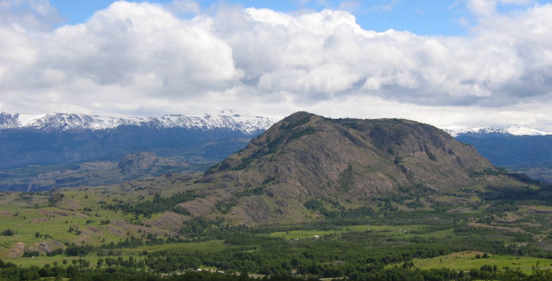
There was one particular stretch of road - no more than 5-10 kilometers long - where every hill looked like (and probably was) an old volcano cone.
A few dozen kilometers more and we'd reached the territory of Parque Cerro Castillo - a large park that we'd be driving through for most of the rest of the day.
At about 5pm, the road dropped down into the valley of Rio Ibañez, and we were faced with a difficult dilemma - turn right or left? Turning left would take us to a city on the north shore of the huge Lago General Carrera - a place where we could catch a ferry across the lake to an Argentinean border crossing. Turning right would take us on a long round-about journey around the west side of the lake. It was only 5pm and it stays light late this far south this close to the summer solstice - so we turned right.
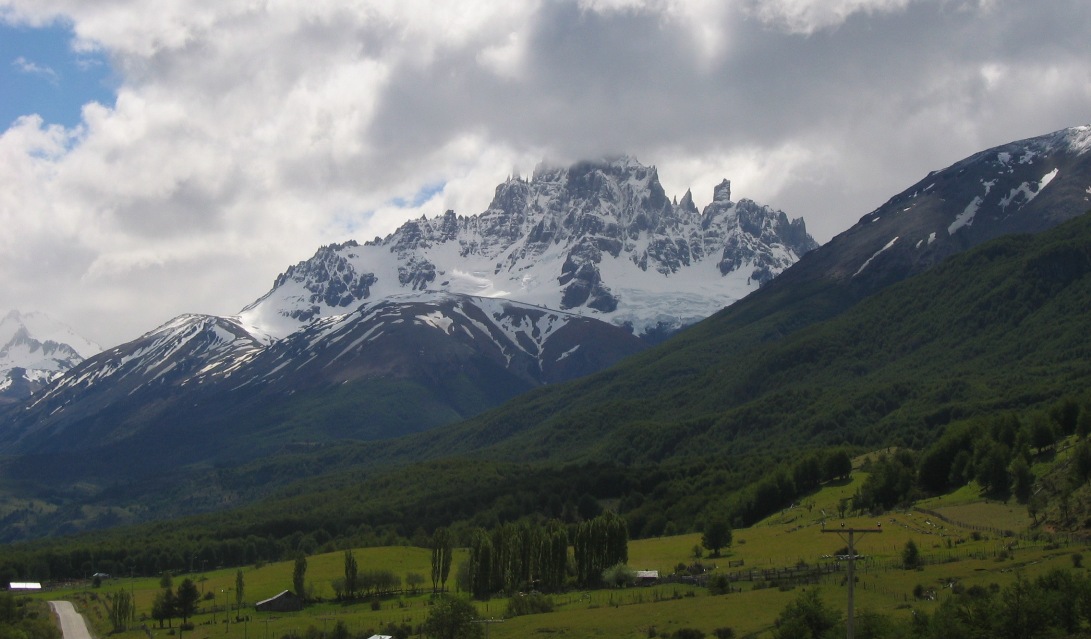
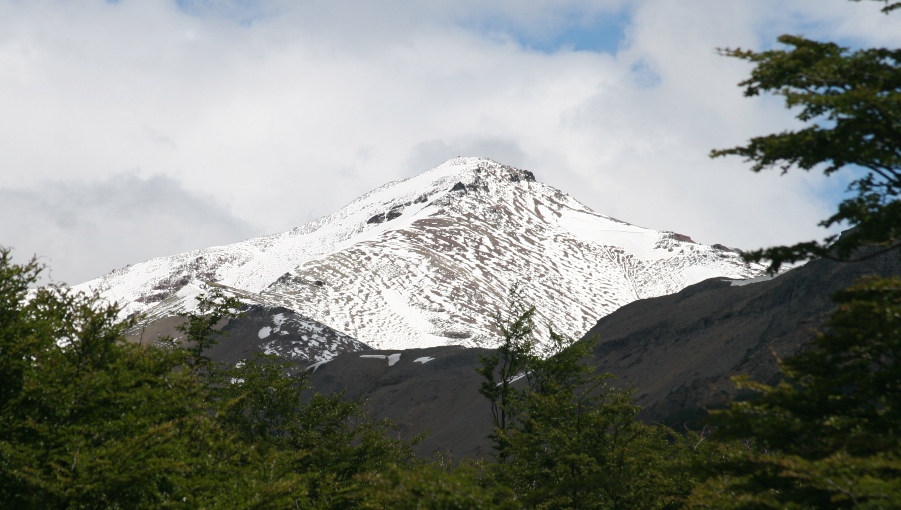
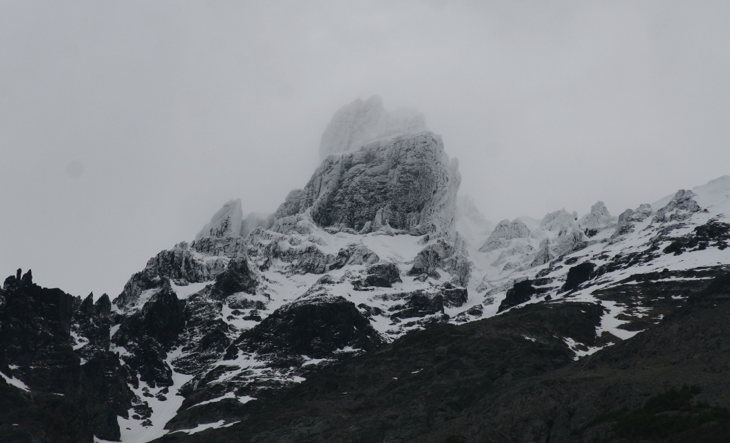
Cerro Castillo - the namesake mountain of Parque Cerro Castillo.
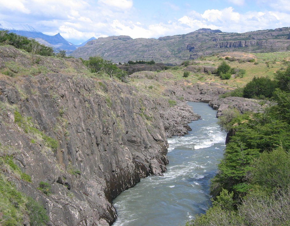
A tributary river running into Rio Ibañez
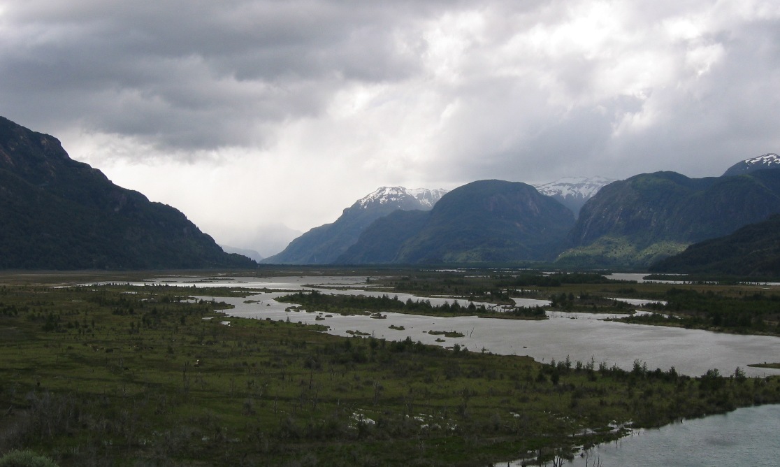
Marshlands along the banks of Rio Ibañez
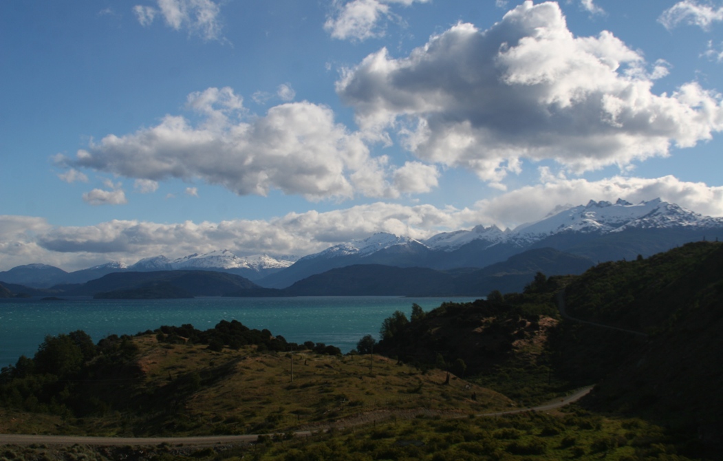
Finally, a little after 6pm, we got our first glimpse of the lake Lago General Carrera. This is the second largest lake in South America (after Titicaca), and although we can easily see across it here, we were looking at a narrow finger that runs north off the main body of the lake. Then after another hour of increasing impatience, mounting hunger, and one re-check of guidebook directions, we arrived at Terra Luna lodge to unpack and eat dinner.
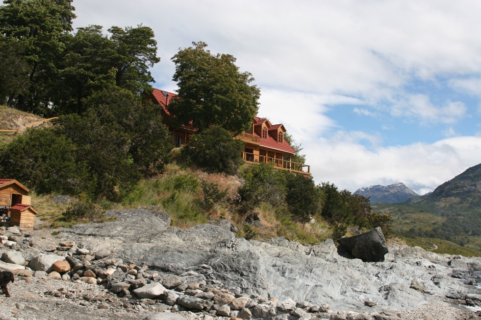
Terra Luna Lodge - Perched above the shore of Lago General Carrera.
At supper we met the owner of the Lodge, Philippe, a Frenchman who in his teens came with his father to Chile. What to do during our visit? Philippe suggested a glacier excursion for the next day (Monday) as it would fit nicely with his pre-made plans to take two other tourists to see Glacier Leon. His description of the trip sounded a a little challenging and definitely quite long, but intriguing non-the-less. A bumpy van-ride would be followed by a 2.5 hour hike followed by a zodiac boat trip across a lagoon to the face of the glacier. Then we'd retrace the same itinerary back to the lodge (without the open bar of drinks over iceberg ice). He usually employs a jet-boat directly from the lodge which would have cut out the van ride, a third of the hike, and about three hours off the total excursion, but he mentioned something about the lake level being a little too low to bring the boat up to his launch as the reason we couldn't use take it. So be it - there was a significant reduction in price to offset the suffering we would endure bumping along in a van and walking on our own two legs, so the offer seemed reasonable enough.
The van trip was uneventful although bumpy as promised and dusty (as not promised) due to a broken rear window and its almost-but-not-quite airtight plastic substitute. Replacement auto windows (and spare parts of any kind) are difficult to come by in the 11th region of Chile. After about 45 minutes heading north (back the way we had come from the day before), Philippe turned off the Carretera Austral to head along a narrow rutted track as it passed westward between the river Rio Leon and a series of small cattle ranches - or perhaps better described as remote places where people who owned some sheep and cows lived.
![]()
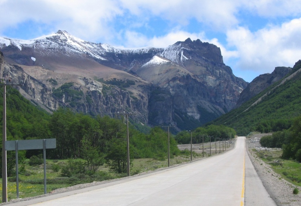
We parked the car where the road stopped, and started walking. The boulders are remnants of a fairly recent landslide.
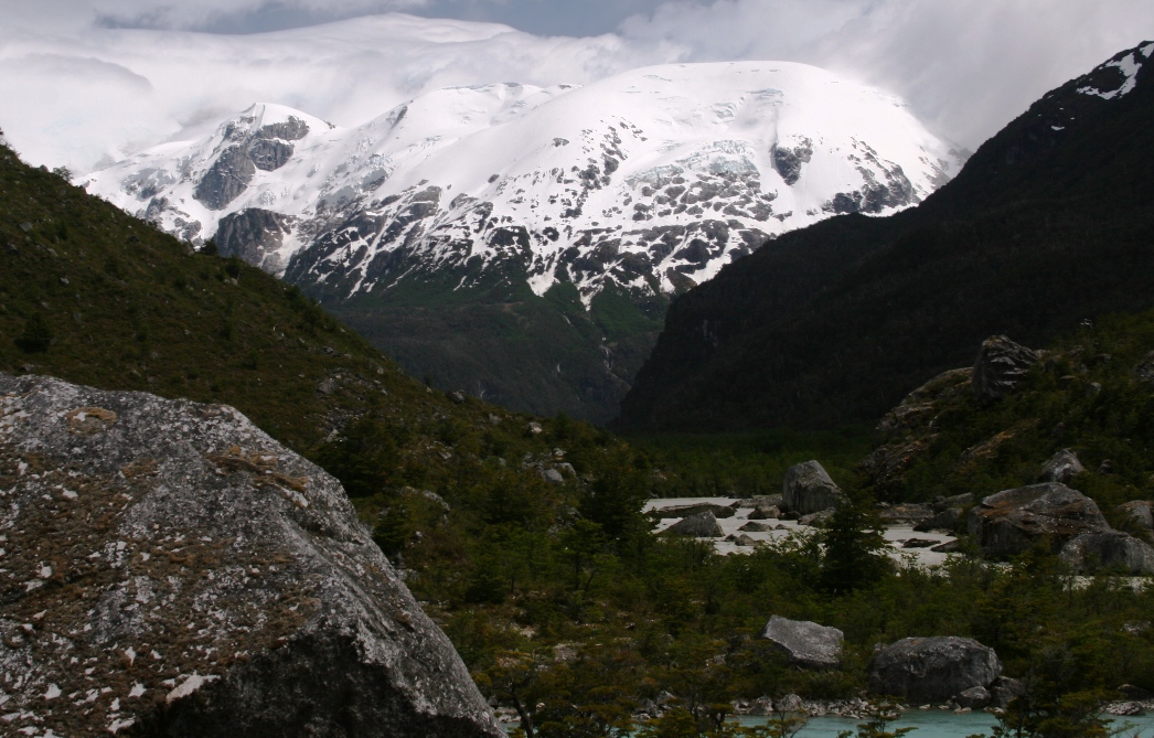
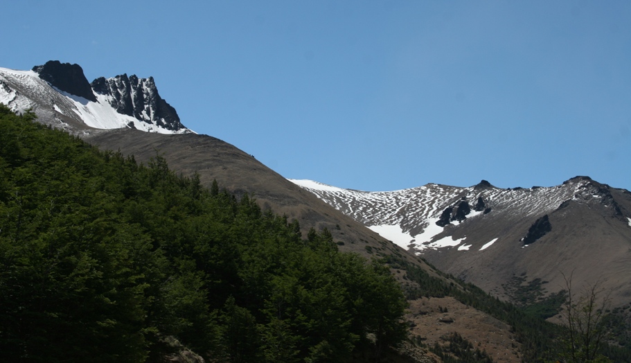
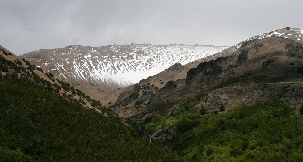
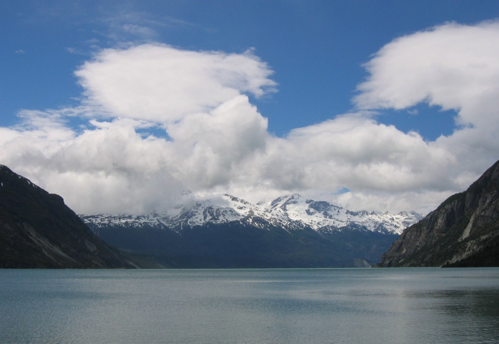
Incredible mountains frame both sides of the river valley.
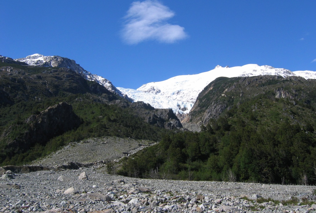
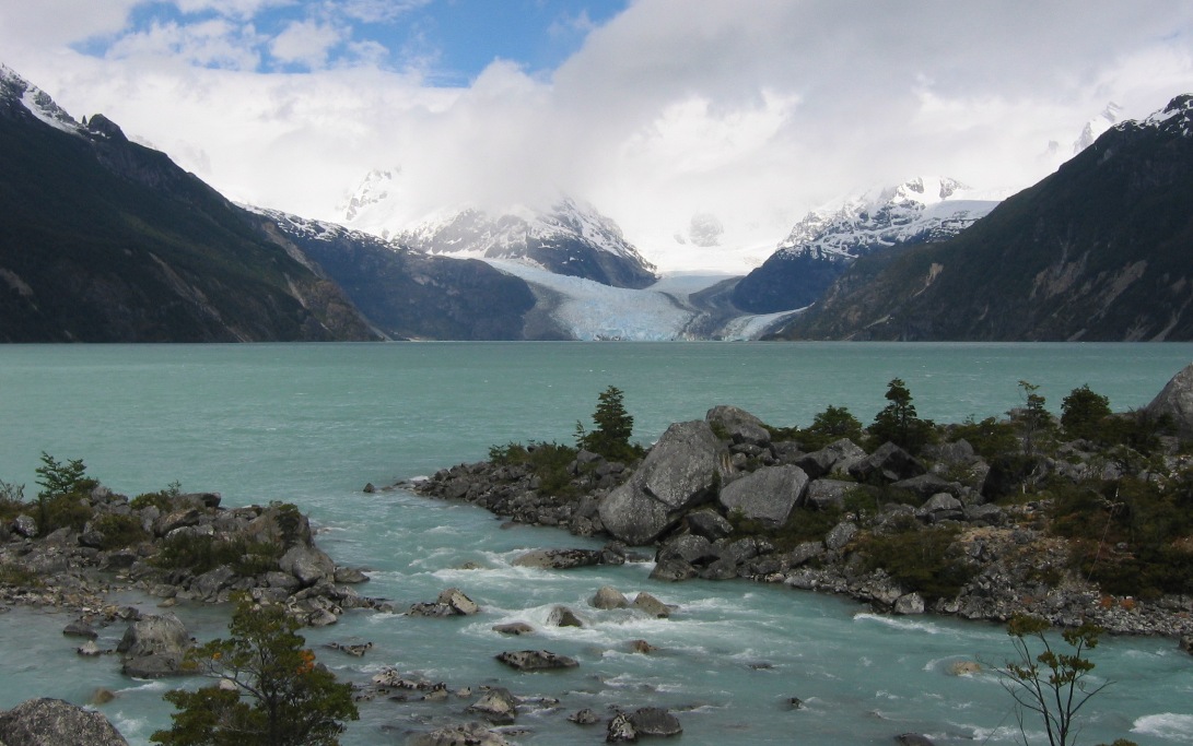
At one point, we passed a huge field of rubble and boulders. There was a landslide here in 2001. A ridge forming a natural dam gave way after heavy rains and allowed the entire contents of a high mountain lake (at the base of the glacier in the picture) to rush down into the river valley, sweeping a large portion of the mountainside down along with it. No one was injured or killed. No one was hiking right here that day.
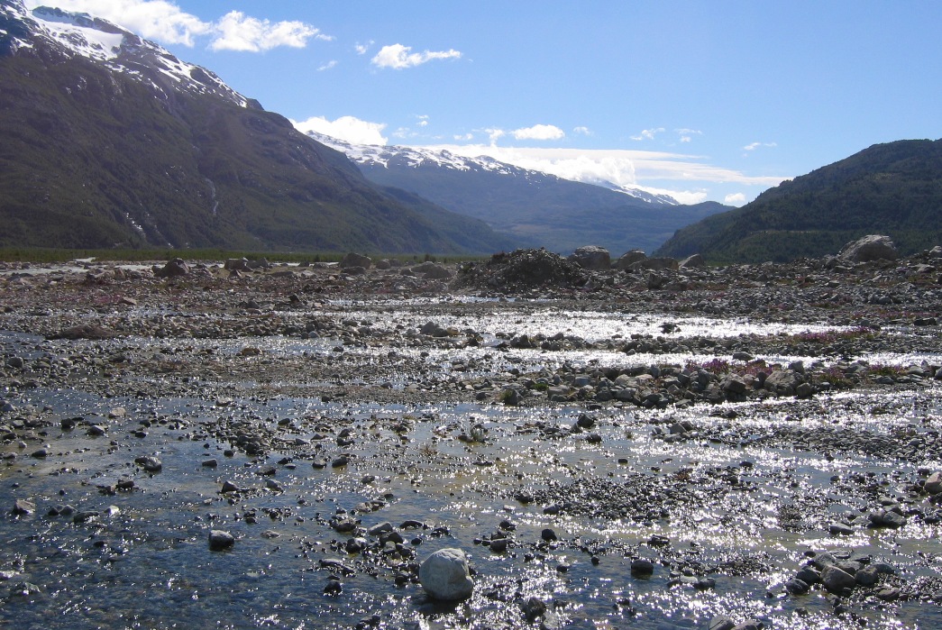
The landslide distorted the river into a wide flat floodplain in places.
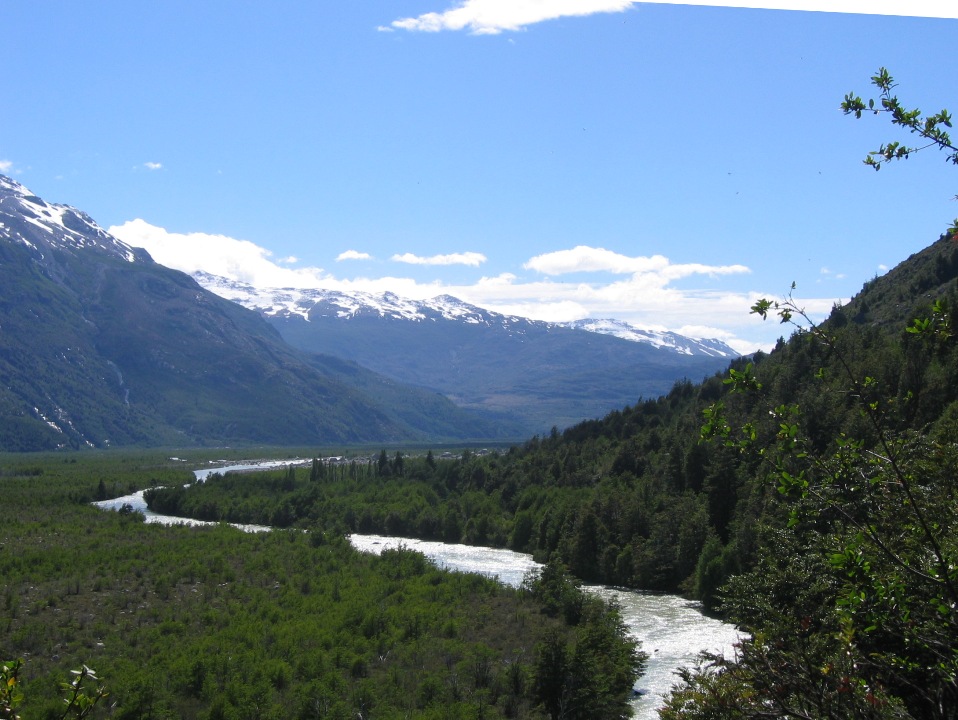
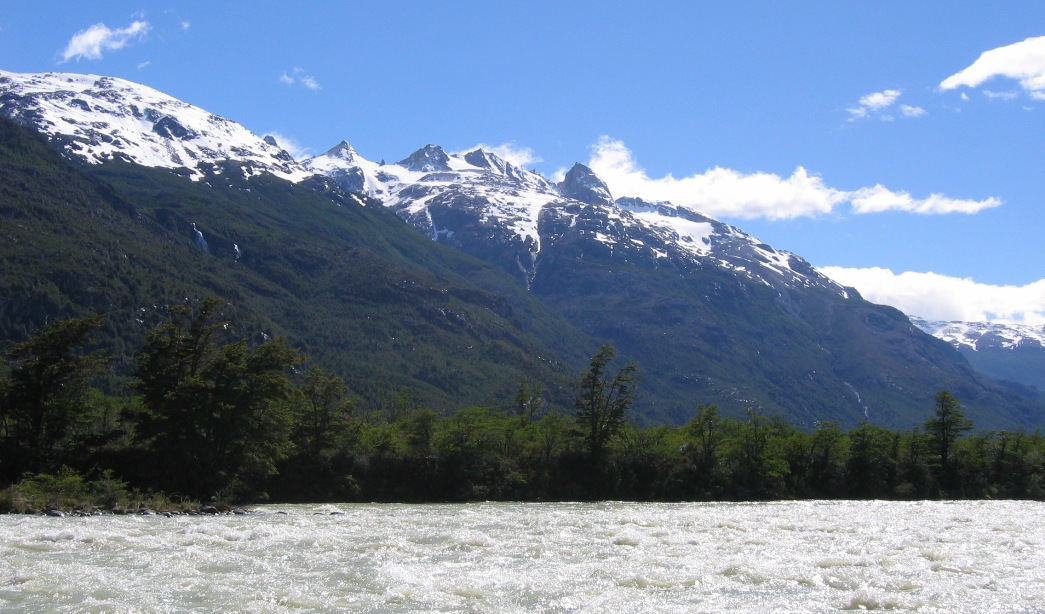
But the rest of the river, "Rio Leones," looked like this...

As promised, after a little over 2 hours, we near the source of the river,
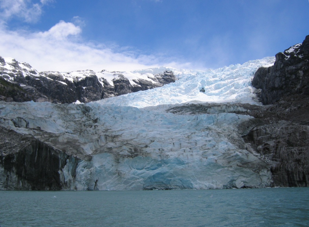
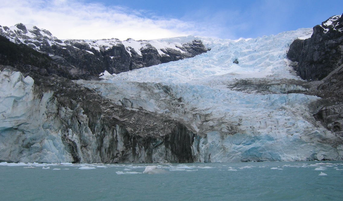
![]()
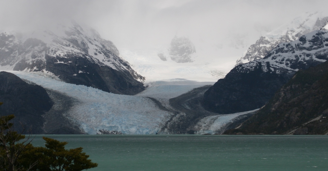
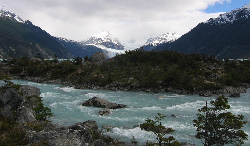
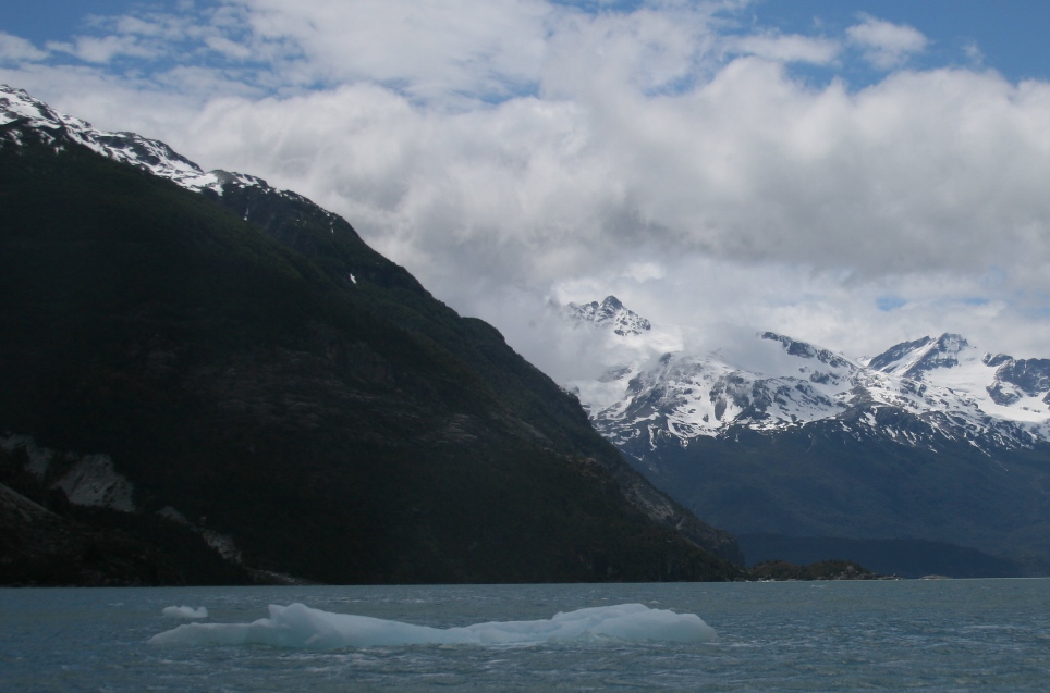
the turquoise-blue Laguna Leones with its water source, Glacier Leones at the far west end. This glacier is located almost directly due east from the San Rafael glacier that we visited two days ago - on the other (inland) side of the Northern Ice-field of southern Chile.
Now it was time to navigate the lagoon via zodiac, so we could get right up in the face of the glacier,
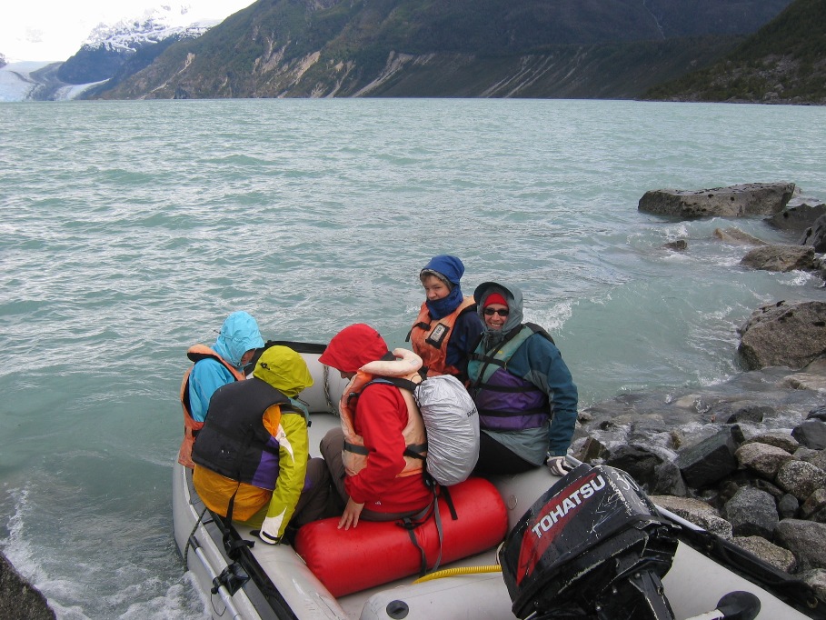
and everyone was still smiling at this point...
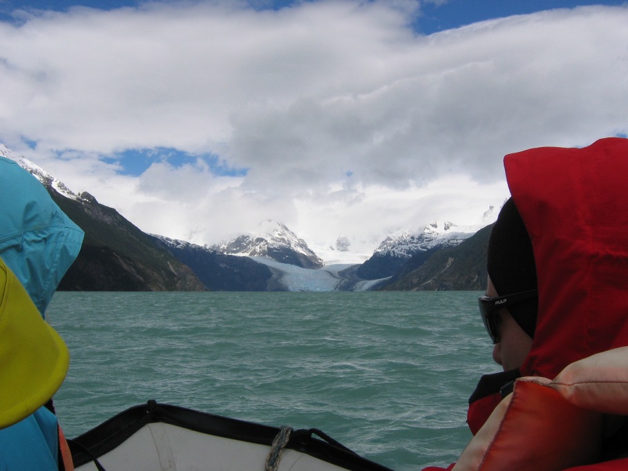
The trip across the lagoon in the zodiac turned out to be excruciating. Philippe had lead us to the lagoon at a quick-step march, barely allowing time for the taking of photos or the re-tying of shoelaces. What was his hurry? He eventually explained; as the day progresses, the wind typically picks up, and as the wind picks up so do the waves on the lagoon.
Now just how big was this lagoon? Only 7 kilometers across! And how long would it be taking us to traverse it in the zodiac? Only about 20 minutes of smooth cruising - without bad wind or high waves, that would be. This day there was worse wind than usual and choppy waves extending across the entire lagoon. Philippe slowed the zodiac down significantly to try to control the splashing, but it was virtually impossible to keep the frigid glacier-melt water from smashing over the tubes of the zodiac and pelting our faces, arms, legs, hands, laps and feet. Once underway and having to hold on to a rope along the side of the bucking boat as if our lives depended upon it (and they surely did), there was nothing we could do but hold tight, endure the agony, and pray for the end (of the boat ride) to come as soon as possible.
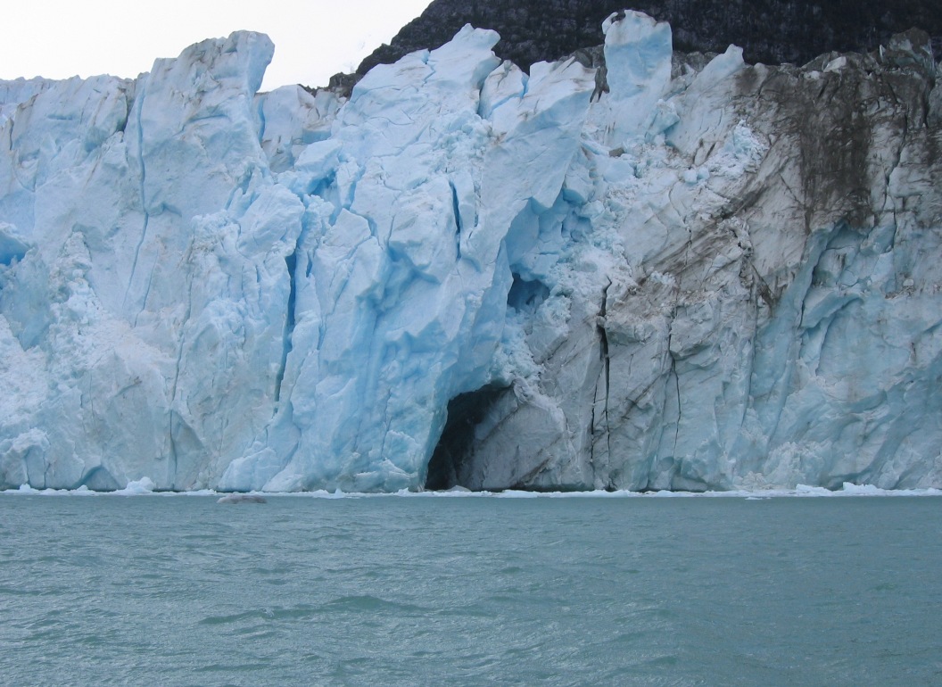
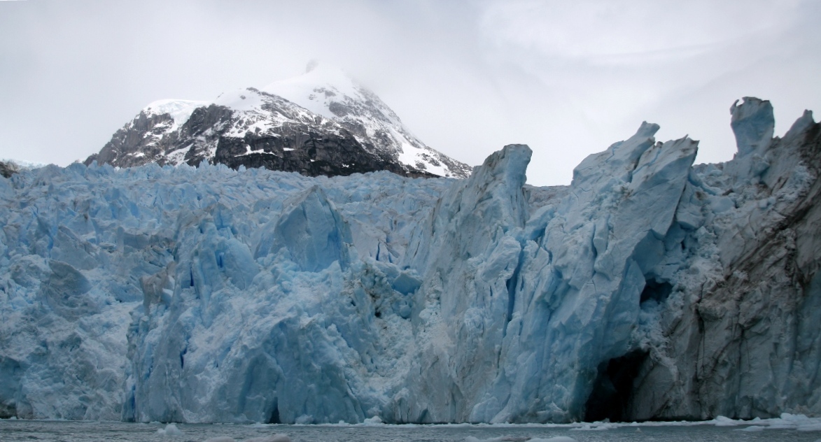
After 35-40 minutest, we did eventually make it to the far side of the lagoon and up close for some amazing views of the glacier, but with fingers so numb it was difficult to push the little button on the camera.
And after turning back around to head for home, we saw the side of the valley we came from.
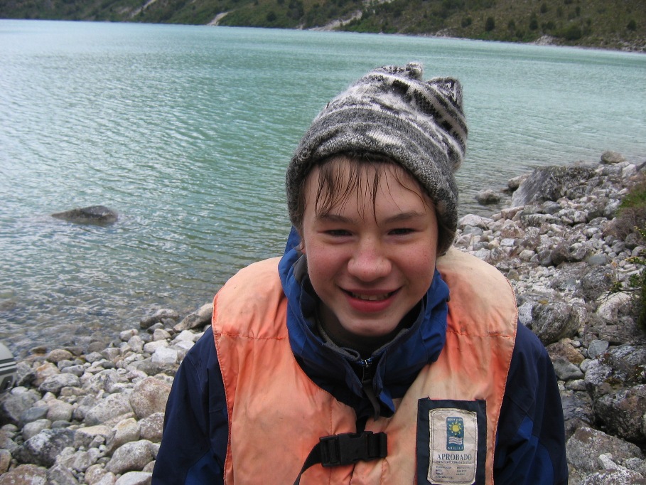
Tom's mouth is smiling, but the rest of his face is screaming "I'm COLD!"
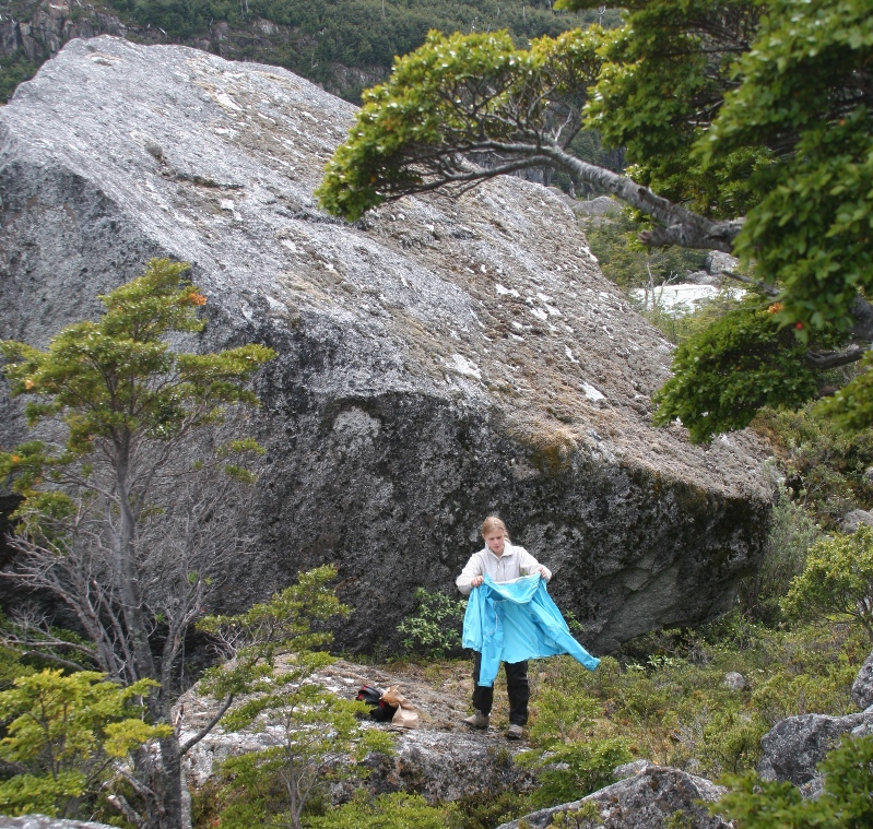
Anna tries to dry off after the return trip across the lagoon - slightly less agonizing with the wind at our backs and the zodiac able to surf the waves to some extent.
The only thing having a hope at warming us up was the trudge back to the van, and the death march did keep us all from freezing, but still no one was completely dried out by the end of the hike. We all sat in exhausted silence while Philippe drove the van back. In spite of our irritation at him for NOT telling us that we might really NEED waterproof gear (in fact, he told us not to worry about anything at that the lagoon crossing was no big deal), I couldn't help thinking about how extremely hard he himself had worked today. He, all five-and-a-half feet of him, drove over 4 hours on ragged bumpy roads, carried 40 pounds of gas in a backpack to the lagoon, mounted and un-mounted the zodiac motor, manhandled the zodiac in choppy waves up against a rocky shore when we loaded and unloaded, etc, etc... But why the heck he didn't give us a better picture of what we might possibly be going through (if it just happened to be a "bad" wave day) and better chance to prepare ourselves, was and still is difficult to comprehend.
Maybe we're just too soft and shouldn't mind sitting in ice water with fierce winds biting into our faces and making our extremities numb. The experience made the luxury of a hot shower and dry clothes all the more heavenly upon our return to the lodge - and the overall experience was undeniably incredible and something we'll always remember.
Dinner was excellent, but it's too bad Lynn couldn't enjoy it - she was probably the wettest and most miserable of all, and by the time we returned to the lodge, having drank too little water and eaten too little food (the lot of us), she was suffering from a nasty migraine which only got worse as the night progressed. Thankfully, the next morning did eventually come and the headache did eventually go away.
******************************************************************
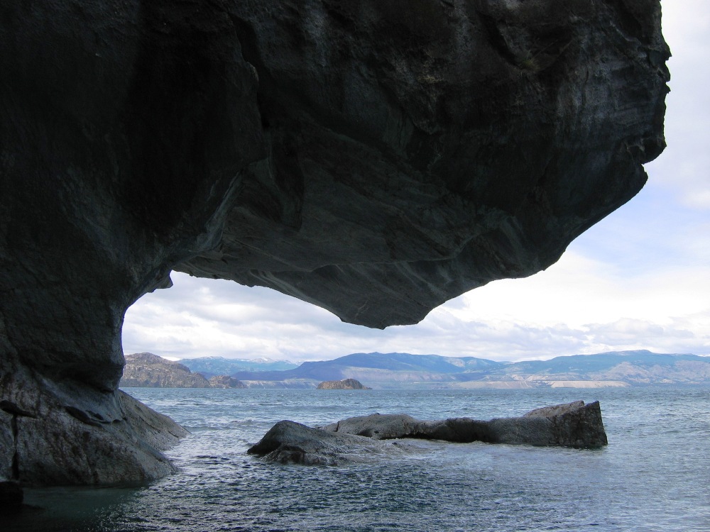
So, what should we do on Tuesday? Anna wanted to go looking for fossils. Philippe told us that we'd have to take a "short" hike with 600 meters of elevation gain to reach the fossil field. Lynn and I convinced Anna to take a short boat ride on the Lago General Carrera (in a protected lagoon very near the shore!) to see some interesting rock formations as the day's excursion instead of hiking to the fossil field. I hate to admit it, but I just didn't want to drag my body up a 600 meter hill after what we'd gone through the day before, no matter how cool the fossils we'd find might be or how great the view would be. Much to my relief, Anna agreed to the boat ride without too much persuasion.
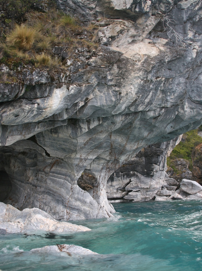
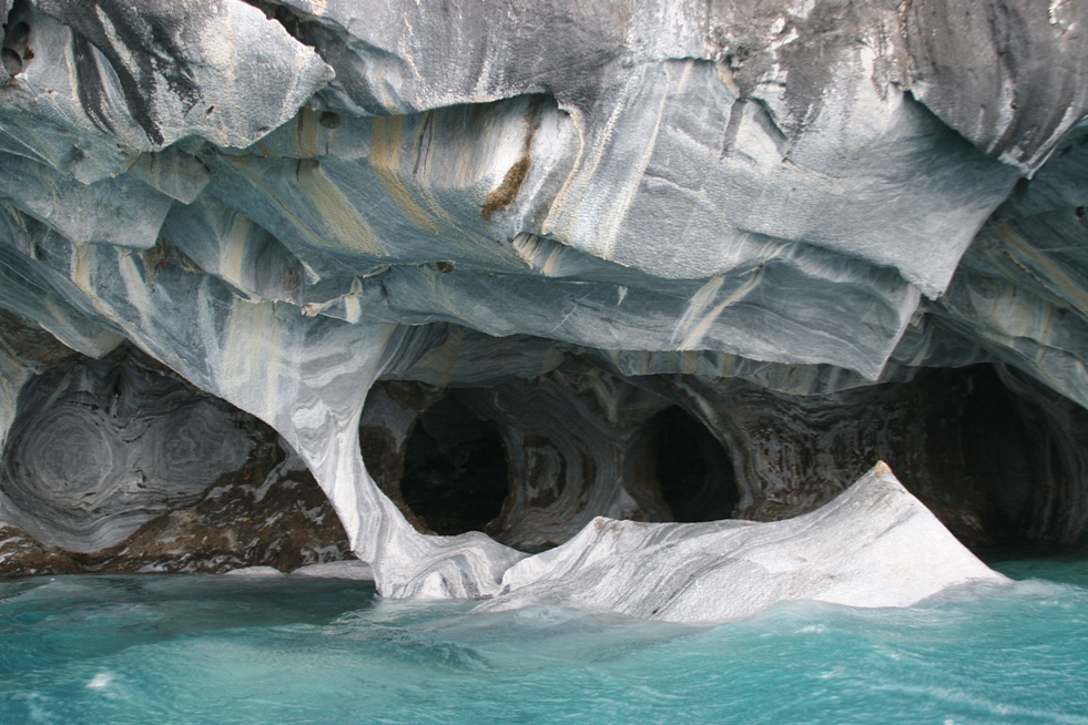
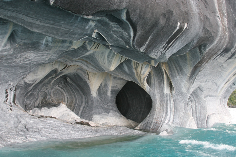
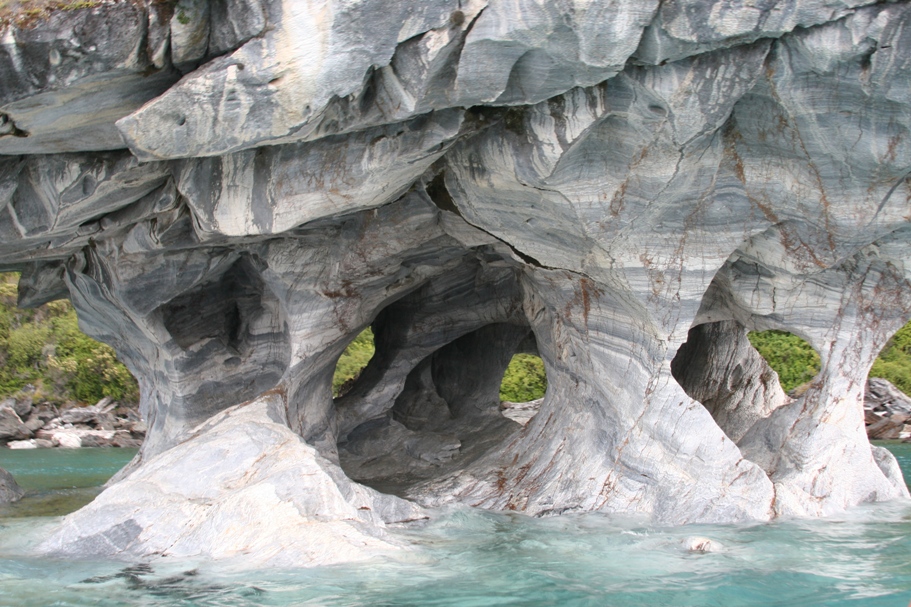
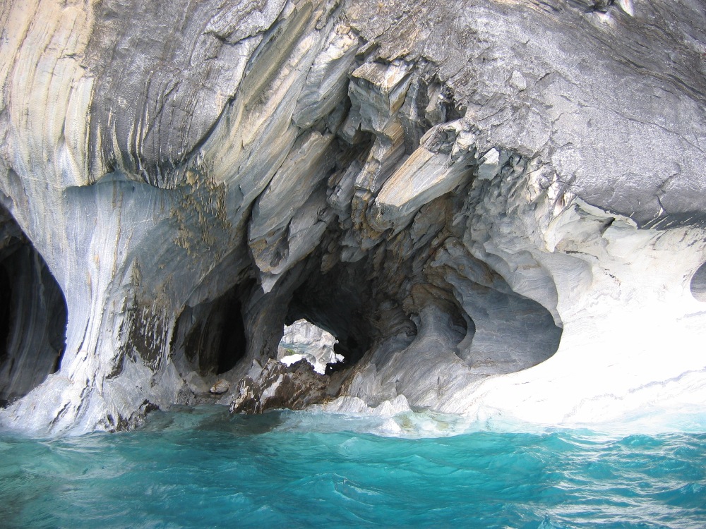
The rock formations near the shore of Lago General Carrera are called "Capillas de Marmól," or "Chapels of Marble." Philippe told us where to find the "best guy to take you out in a boat," and after we found him he took us out in his boat for about 40 minutes. We never got more than a few dozen meters from shore and the wind and waves were tame. Fantastic! "The guy" didn't say much, but when I asked him about how the rock formations were created, he said something like,
"Buy the glaciers, about 300,000 years ago. The same glacier that carved out the whole lake."
Later, back at the lodge, I asked Philippe the same question. He told us,
"No, they weren't made by glaciers. They have been made by the erosion forces of the wind and waves."
Take your pick. We decided to believe Philippe.
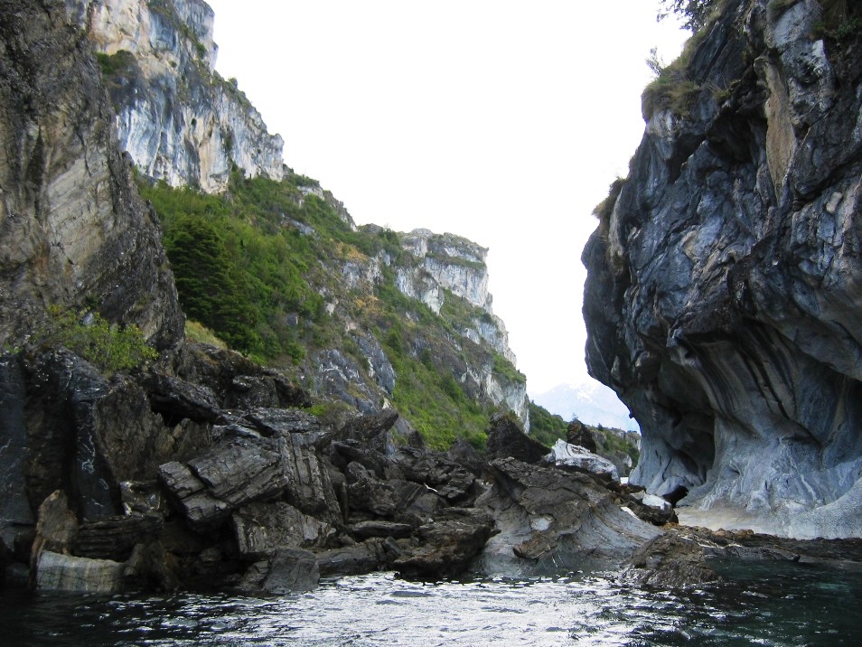
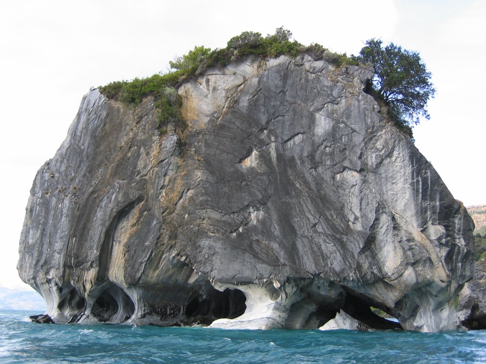
Capillas de Marmôl.
And finally, today in the morning, we packed up to leave not only Puerto Guadal, but the country of Chile as well. More than 5 months after arriving back in late June (Rolf) or early July (the rest of the family), it's time for something different.
One relatively short (less than 3 hours) drive along one of the most recently completed and precarious looking peripheral spurs of the Carretera Austral took us eastward along the southern shore of Lago General Carrera to the border city of Chile Chico. What reason there might be to put a city is here is difficult to comprehend, other than it a settlement on the Chilean side of an international border. Anyway, we didn't stay long, opting to cross the border and try Argentinean cuisine for lunch.
![]()
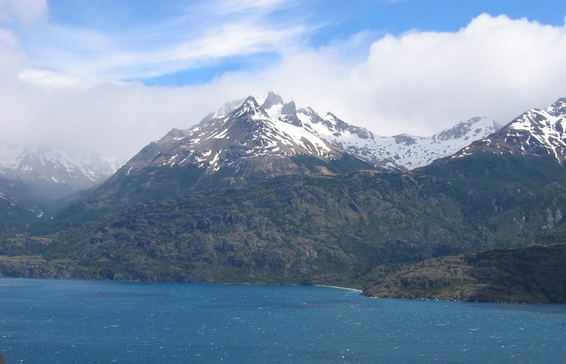

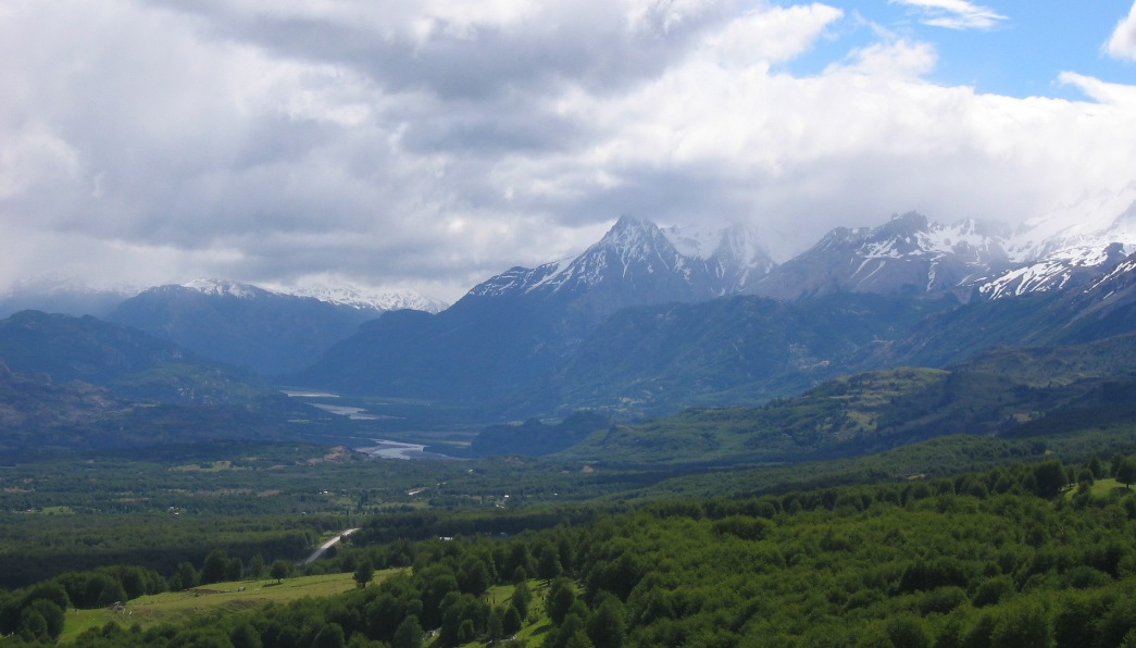
Goodby Lago General Carrera.
![]()
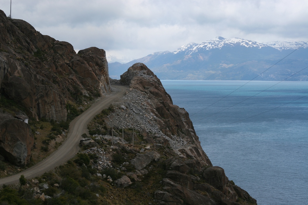
Goodbye Carretera Austral.
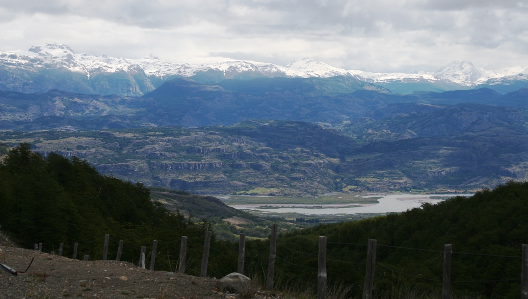
Goodbye Chile! (looking down on Chile Chico - the road arrives at the border with Argentina just a few kilometers past where it disappears at the top of this picture.
![]()
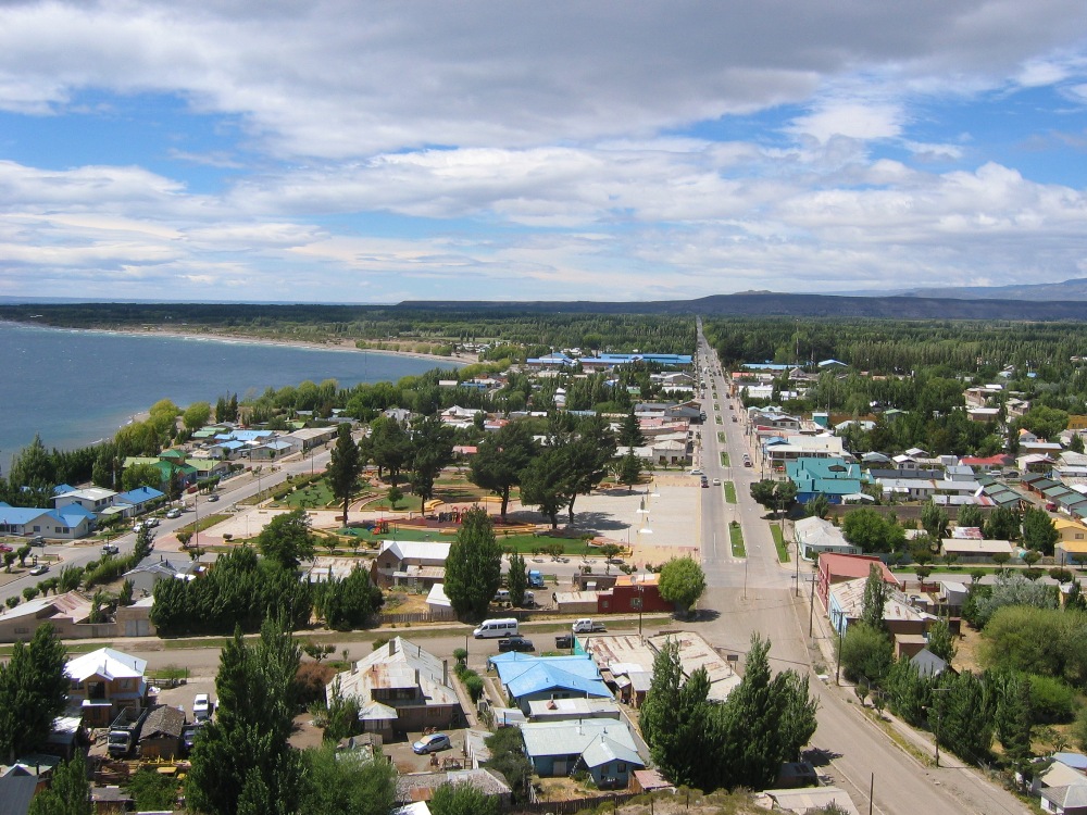
Hello Argentina!
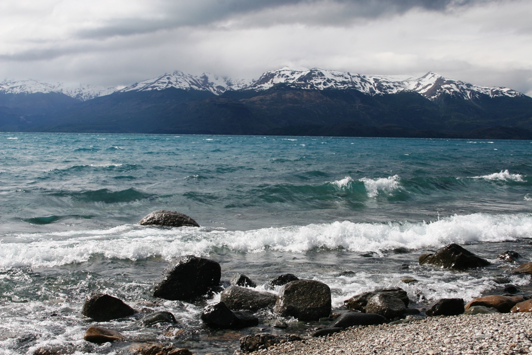
After we followed the road across the border, we continued along the lake which changed its name to "Lago Buenos Aires" in honor of being in a new country. The lake extends another 50 kilometers or so into Argentina. The terrain turned dry and barren - the famed pampas perhaps? Although the land turned brown, flat, and dry, the water looked as turquoise and wet as ever. Some things don't change no matter what country you're in.
-Rolf